abstract
Forest Solutions

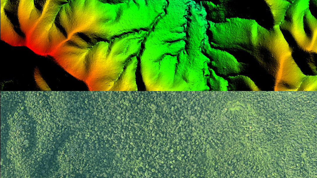
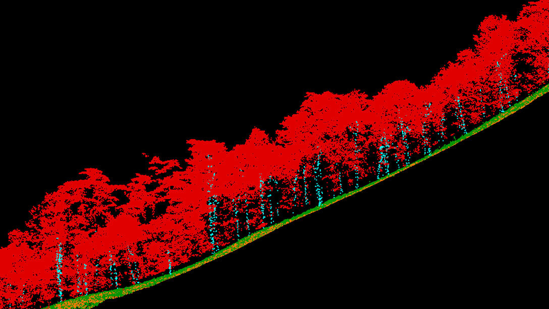
Highly Accurate 3D LiDAR Data of Complete Forest including Tree Structure & Forest Floor details

Forest Mapping requires complete tree structure and forest floor mapping. Use the power of 3D Mapping using LiDAR to penetrate tree canopies and provide completely accurate forest data in short times.

abstract
Forest Solutions
Forest Metrics
Forest Metrics
High density Point Cloud for Forest Metrics
5 cm Orthophotos
Tree Segmentation
Canopy Base Height Information
Carbon Stock Estimation
Forest Quality Assessment
Success Stories
  • MoEF Forest Mapping Project
Soil & Moisture Conservation
Watershed Management using Ridge to Valley Approach
Stream Identification
Soil Erosion Mapping
Slope Failure Identification
Location & Design of Micro Structures for Soil & Moisture
Conservation
Success Stories
  • MoEF Forest Mapping Project
Soil & Moisture Conservation
Forest GIS & Solutions
Digitization of Forest Boundaries
Forest Density Mapping
Forest Watershed Mapping
Encroachment Management
Illegal Tree Felling Monitoring
Forest Fire Management
Wildlife habitation analysis
Our Technology & Solution
Aerial LiDAR Mapping
Mobile LiDAR Mapping
UAV LiDAR Mapping
Terrestrial LIDAR
Flood Management
Aiport I
Solar Rooftop Calculator